Drawing on 30 years of expertise in mapping technology, MRF proudly presents real-time GNSS position tracking, seamlessly transmitted to dedicated monitoring centers and affiliated organizations.
MRF offers comprehensive vehicle and personnel tracking solutions throughout Canada, serving both rural and urban municipalities. With our tracking module, you gain access to features such as vehicle management, SOS alerts, integration with vehicle sensors, and the ability to maintain detailed records of vehicle movements.
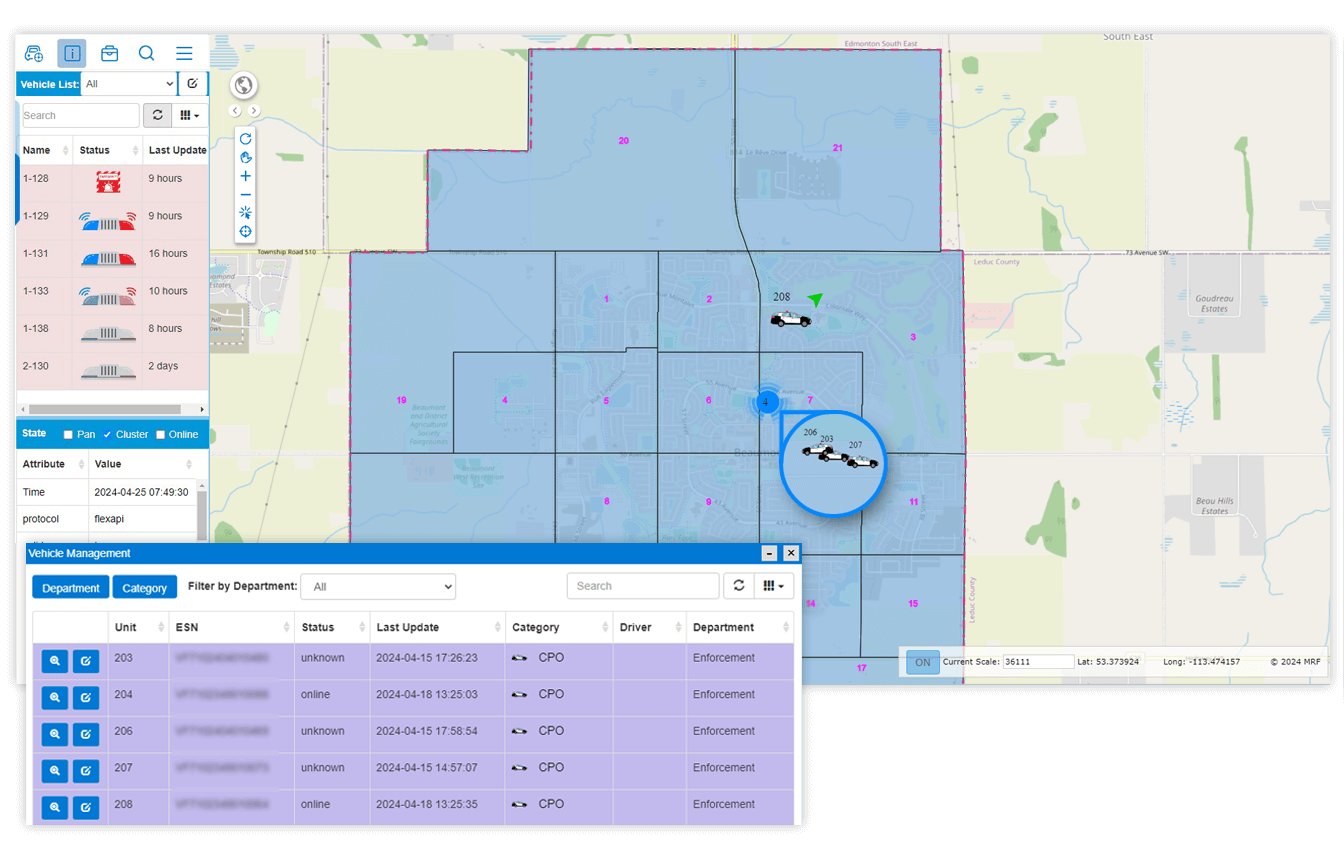
The tracking module is integrated into the MRF Web Map, offering distinctive advantages for users. Users can leverage their own municipal datasets, encompassing road networks, addresses, and other pertinent mapping layers. By clicking on a road segment, users can access all associated attributes. Similarly, they can retrieve information on addresses, including owner details, commercial buildings, schools, and any other data available in your municipality's GIS dataset.
Enhance officer safety with optional SOS alert capabilities, supported by vigilant monitoring of crucial systems such as lights and sirens. The majority of our customers opt for tracking their vehicles' locations every 30 seconds. However, with our tracking module, vehicle positions can be tracked as frequently as every two seconds, providing even greater precision when necessary.
Take advantage of robust in-vehicle Ethernet and Wi-Fi capabilities, further augmented by integrated cellular signal boosting technology. This ensures officers have reliable internet access while in the field.
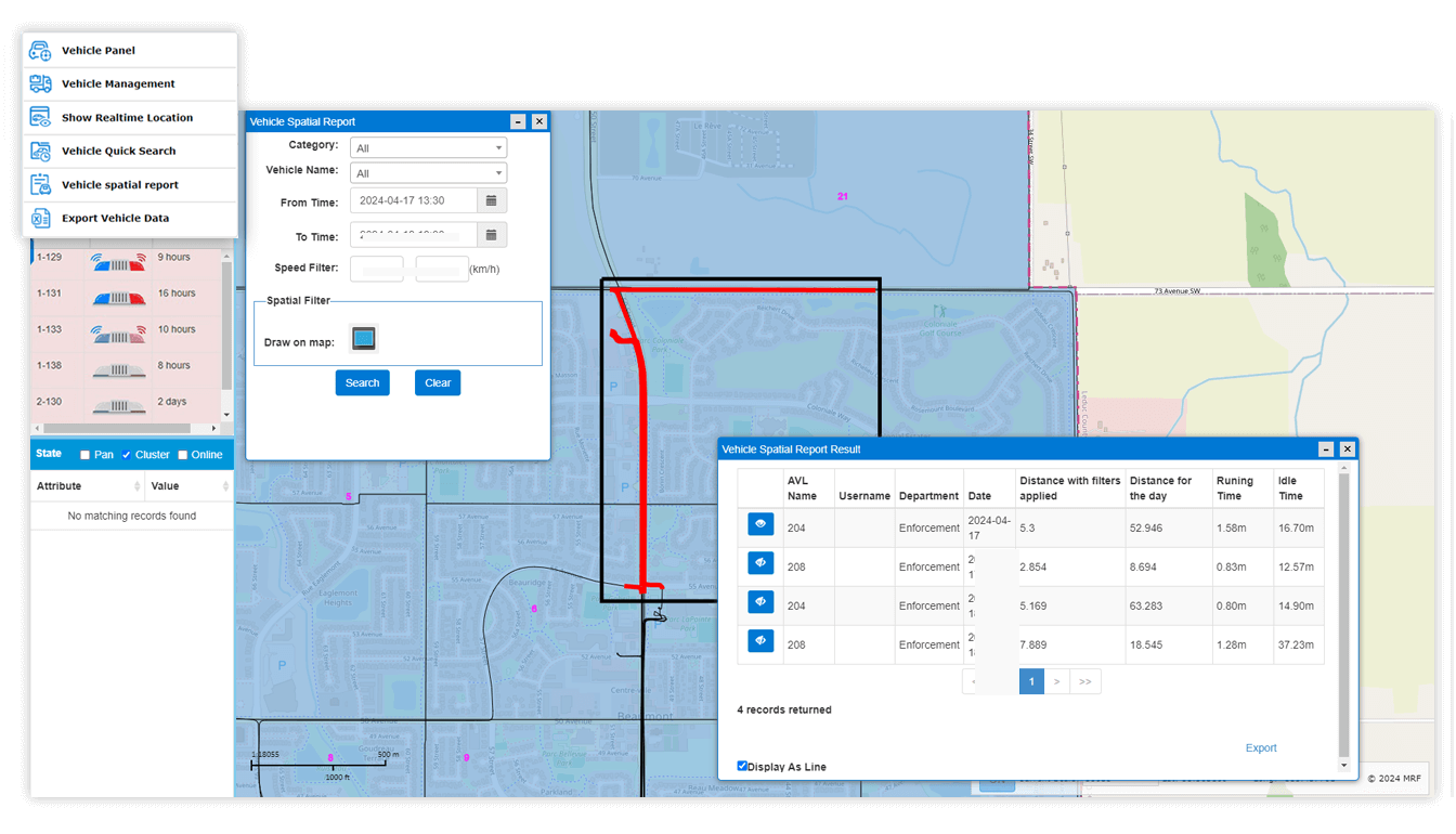
Display precise data indicating the whereabouts of vehicles through the window depicted in the image below. MRF has delivered tracking services to Fire, Enforcement Agencies, Public Works Departments, and Agriculture Departments.